


Using drones for roof measurements has revolutionized the way roofing professionals assess and analyze roofs. With the advancement of technology, drones equipped with high-resolution cameras can provide accurate measurements and detailed images of roofs, making the process faster, safer, and more efficient.
Measuring a roof with a drone involves flying the drone over the roof while capturing images and videos. These images are then processed using specialized software to generate 3D models and measurements of the roof’s dimensions, slope, and area. This data is crucial for estimating material requirements, planning repairs, and assessing the overall condition of the roof.
Benefits of using drones for roof measurements include increased accuracy, reduced time and cost, improved safety by eliminating the need for manual inspections, and the ability to access hard-to-reach areas. Whether you are a professional roofer or a homeowner looking to assess your roof, using a drone for measurements can provide valuable insights and streamline the roofing process.
Essential Steps for Measuring Roof with a Drone
Using a drone to measure a roof can save time and provide accurate measurements. Here are the essential steps to ensure a successful measurement:
1. Plan Your Flight
Before taking off, plan your flight path to cover the entire roof area. Make sure to set the appropriate altitude and camera angle for optimal results.
2. Capture High-Quality Images
Ensure your drone captures high-resolution images of the roof from multiple angles. This will help in creating detailed 3D models and measuring dimensions accurately.
By following these essential steps, you can effectively measure a roof using a drone and obtain precise measurements for your roofing project.
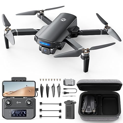
Choosing the Right Drone for Roof Measurement
When it comes to measuring a roof with a drone, choosing the right drone is crucial for accurate and efficient results. Here are some key factors to consider when selecting a drone for roof measurement:
| 1. Camera Quality: | Opt for a drone with a high-resolution camera to capture clear images of the roof surface, enabling detailed measurements. |
| 2. Flight Time: | Choose a drone with a longer flight time to cover larger roof areas without the need for frequent battery changes. |
| 3. Stability and Control: | Look for a drone with stable flight capabilities and easy control features to ensure smooth and precise roof measurements. |
| 4. GPS Accuracy: | Opt for a drone with accurate GPS technology to enhance positioning and mapping accuracy for roof measurement tasks. |
| 5. Portability: | Consider the size and weight of the drone for easy transport to different job sites for roof measurement projects. |
By considering these factors, you can select the right drone that meets your roof measurement needs and helps you achieve precise and efficient results.
Understanding Drone Mapping Software
Drone mapping software plays a crucial role in accurately measuring roofs using drones. It allows users to create detailed maps and 3D models of the area being surveyed. Understanding how drone mapping software works is essential for obtaining accurate and reliable data.
Key Features of Drone Mapping Software:
1. Orthomosaic Imagery: Drone mapping software stitches together hundreds of individual images captured by the drone to create a high-resolution orthomosaic image of the roof.
2. Point Cloud Generation: The software processes the collected data to generate a point cloud, which represents the roof’s surface in 3D, enabling accurate measurements to be taken.
Benefits of Using Drone Mapping Software:
By utilizing drone mapping software, users can efficiently measure roofs, identify potential issues, and plan for repairs or replacements with precision. This technology streamlines the surveying process and improves data accuracy, making it a valuable tool for roofing professionals.
Calibrating Drone for Accurate Measurements
Before you start measuring a roof with a drone, it is crucial to calibrate your drone to ensure accurate measurements. Calibration involves adjusting the drone’s sensors and settings to account for any environmental factors that could affect the accuracy of the measurements. Here are some steps to help you calibrate your drone:
1. Check the drone’s firmware and software to ensure they are up to date. This will ensure that the drone’s sensors are functioning properly and accurately.
2. Conduct a pre-flight check to ensure that all components of the drone are working correctly. Check the GPS signal strength, compass calibration, and camera alignment.
3. Fly the drone in a test area to verify its stability and accuracy. Take measurements of known objects or distances to check the drone’s measurement accuracy.
4. Adjust the drone’s settings if necessary to improve its accuracy. This may involve adjusting the drone’s altitude, speed, or camera settings.
5. Repeat the calibration process regularly to ensure that the drone’s measurements remain accurate over time.
By calibrating your drone properly, you can ensure that the measurements you take of a roof are accurate and reliable, helping you to plan and execute roofing projects with confidence.
Planning Your Roof Measurement Flight Path
Before taking your drone out for a roof measurement flight, it is essential to plan your flight path carefully. Here are some steps to help you plan your flight:
- Study the layout of the roof you want to measure and identify any obstacles that may interfere with your flight.
- Determine the best starting point for your drone to ensure complete coverage of the roof area.
- Plan a flight path that allows your drone to capture images of the entire roof from multiple angles.
- Consider the weather conditions and time of day for optimal lighting and visibility.
- Ensure that your drone’s battery is fully charged and that you have enough storage space for the images and data you will collect.
- Check for any legal restrictions or requirements for drone flights in the area where you will be operating.
By carefully planning your roof measurement flight path, you can ensure accurate and comprehensive data collection for your roofing project.
Executing the Roof Measurement Flight
To measure a roof with a drone, you need to plan and execute a systematic flight over the area of interest. Follow these steps to ensure accurate measurements:
- Pre-flight Check: Before takeoff, make sure your drone is fully charged, the camera settings are optimized for aerial photography, and the GPS signal is strong.
- Set Waypoints: Use a flight planning app to set up a grid pattern for the drone to follow. This will ensure complete coverage of the roof area.
- Takeoff and Fly: Launch the drone and let it follow the pre-set flight path. Make sure to maintain a safe altitude and distance from obstacles.
- Capture Images: As the drone flies over the roof, capture high-resolution images of the entire area. Ensure there is enough overlap between images for accurate stitching.
- Return and Land: Once the flight is complete, bring the drone back to the starting point and safely land it. Check the images to confirm coverage and quality.
By following these steps, you can effectively measure a roof using a drone and obtain precise measurements for assessment and planning purposes.
Analyzing and Interpreting Data from Drone Measurement
Once you have captured the necessary images of the roof using a drone, the next step is to analyze and interpret the data collected. This process involves using specialized software to stitch the images together, creating a detailed map of the roof’s surface.
By analyzing this data, you can accurately measure the dimensions of the roof, including the area, pitch, and slope. This information is crucial for estimating materials needed for repairs or replacements and calculating costs.
Furthermore, interpreting the data allows you to identify potential issues with the roof, such as areas of damage or wear. This insight can help you prioritize maintenance tasks and plan for future renovations.
Overall, analyzing and interpreting data from drone measurements provides valuable information that can streamline the roof inspection and estimation process, saving time and resources in the long run.
FAQ
Is it possible to measure a roof with a drone?
Yes, it is possible to measure a roof with a drone. Drones equipped with cameras and software can provide accurate measurements of roof dimensions and area.
How accurate are the measurements taken by a drone for roofing?
The accuracy of measurements taken by a drone for roofing can vary depending on the drone’s capabilities and the software used. However, drones can provide measurements with high accuracy, often within a few centimeters.
What are the advantages of using a drone to measure a roof?
Using a drone to measure a roof offers several advantages. Drones can access hard-to-reach areas, provide measurements quickly, reduce the need for manual labor, and offer a safer alternative to traditional measurement methods.
Can drones be used for other purposes in the roofing industry?
Yes, drones have various applications in the roofing industry apart from measuring roofs. They can be used for roof inspections, thermal imaging, detecting leaks, monitoring construction progress, and creating 3D models of buildings.


